| Back to Back Issues Page |
 |
|
Bangkok Travelbug February 2017 Bang Rachan Memorial Park Singburi January 26, 2017 |
| Hello
Burmese offensive – 1764 - 1766 Early in his reign, King Hsinbyushin (1763 – 1776) assembled a massive army to suppress the rebellious city kingdoms in Siam. The Burmese order of battle consisted of 100 war elephants, 1,000 cavalry and 20,000 infantry. In March 1764, this force of 30,000, including other troops invaded Lan Na Kingdom at Chiang Rai and Chiang Mai; both cities were quickly subdued. Luang Prabang in Lan Chang Kingdom (present day Laos) was next and by early 1765, the Burmese reinforced by troops from the cities they captured, were poised for the assault on Ayutthaya to the south. 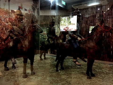
Burmese cavalry on the move They swept all the cities on their way south; Tak, Kamphaengphet, Sukhothai, Phitsanulok, Nakhon Sawan and by July 1765 reached Wiset Chai Chan (present-day Ang Thong), the frontier of Ayutthaya. From the south, a force of 30,000 Burmese troops consisting of 1,000 war elephants, 1,000 cavalry and 20,000 infantry, overran Chumphon and Phetchaburi. From the west, another force came through the Three Pagoda Pass and took Kanchanaburi, Ratchaburi and Suphanburi. When all these forces met, the trap was sprung – Ayutthaya was completed isolated. Not even the coming rains could save her this time. Contents Skirmishes on the frontier Mid-1765 – the Year of the Rooster Burmese patrols at the outskirts of Wiset Chai Chan, a frontier town 34 km north-west of Ayutthaya, were foraging for food and material, looting, capturing prisoners for slaves and burning villages to the ground. 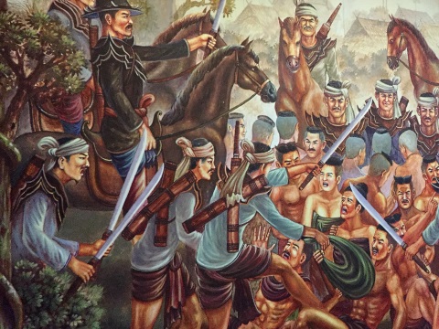
War captives The villagers of Wiset Chai Chan rallied to defend their town. After initial success, they were soon overwhelmed and the town fell to the Burmese. The survivors escaped to join the fortified village of Bang Rachan 20 km to the north. Contents Siege of Bang Rachan Bang Rachan is surrounded by numerous canals, ponds, and other waterways that are linked to provide a natural irrigation network. This gave the villagers in the area ample water for rice and other cultivation and also a constant supply of fish. (Please see map below). This feature also contributed to the defence of the village by hindering the movement of the attackers and channelling them to certain routes. It also provided the food and water during the Burmese siege. The Bang Rachan stockade became a refuge for all the villagers in the area fleeing the Burmese and these people reinforced the defence. Though out-gunned and out-numbered, Bang Rachan held out for five months and repelled eight Burmese attacks. On Monday, the second night of the waning moon in the third Lunar month in 1766, the Year of the Dog, Bang Rachan fell to the Burmese. 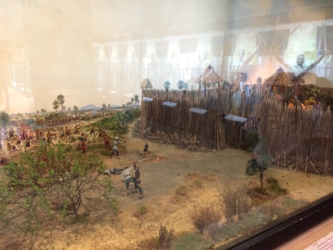
The heat of battle Those who survived the battle were either captured as slaves or put to the sword and the village burnt to the ground. The Burmese continued their onslaught southwards and laid siege to Ayutthaya. On 7 April 1767, Ayutthaya fell for the second time in 200 years. This time the city was totally destroyed and a line of 36 kings came to an abrupt end. Contents Bang Rachan Memorial Park In the midst of a military campaign that was a total disaster for the Siamese, Bang Rachan was like a beacon in a season of despair. However, for the next two centuries, the site of this heroic battle was abandoned. It was only in 1950 that the Thai government decided to restore the site and build the Bang Rachan Memorial Park as a tribute to those who died in that battle. The memorial park covers an area of 18.4 hectares or 45.5 acres and was officially open by King Rama IX on 29 July 1976. It consists of three areas:
Visit the museum first; it’s divided into two sections, the first displays handicraft and life in the past in Bang Rachan and Singburi, the second is on Fort Bang Rachan, the war, old weapons used and a mock-up of the fort. 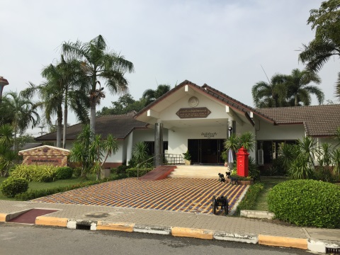
The Centre of Historical Studies and museum building Scenes from the past These models of village life in the past give visitors of what life was like back then. 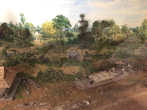
Scenes from the past Nang Yai or giant puppets are also a speciality of Singburi and the Nang Yai Museum and Art Centre in Wat Sawang Arom, Singburi City is dedicated to this handicraft. 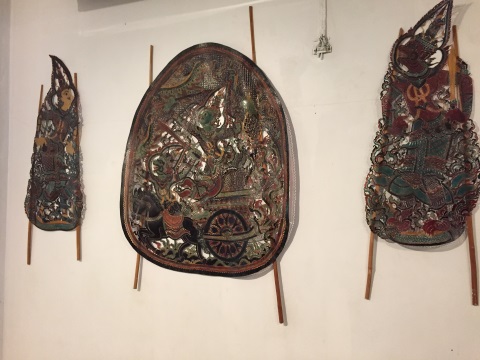
Handicraft of Singburi Fort Bang Rachan Heroes’ Museum 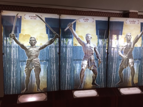
Heroes’ Gallery 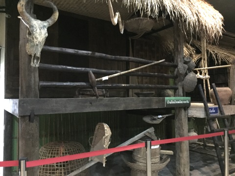
Model of an old Thai house from that period 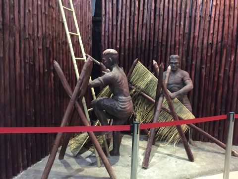
Manning the stockade 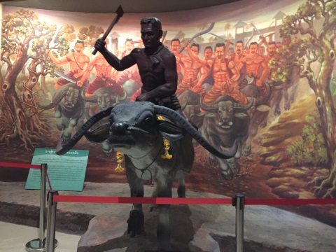
Buffalo cavalry 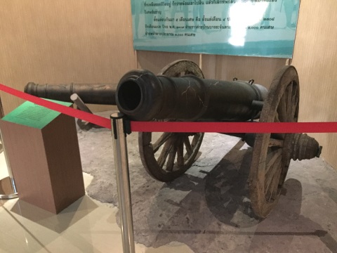
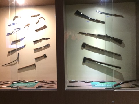
Old weapons from that period The historical park and monument The historical park is a vast area with model and live-size traditional Thai huts. 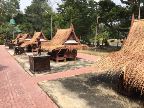
Model traditional Thai huts 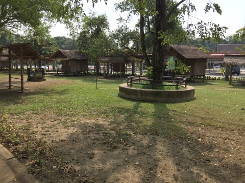
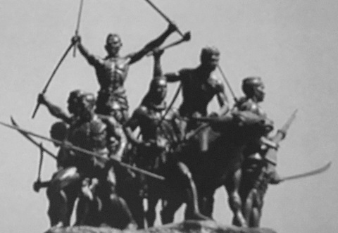
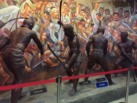
Traditional Thai houses The centrepiece of the historical park is the Bang Rachan Heroes’ Monument. There are eleven figures in the monument with each figure representing a specific person. 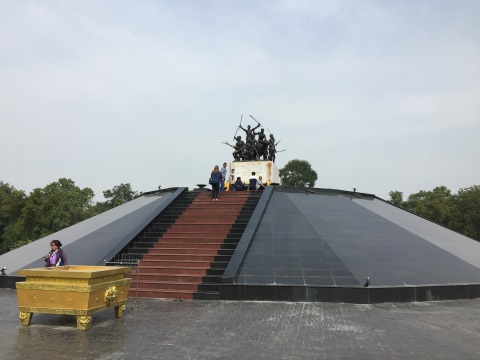
Bang Rachan Heroes’ Monument 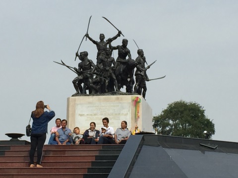
A family photo to remember 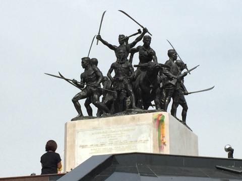
Close-up of the monument 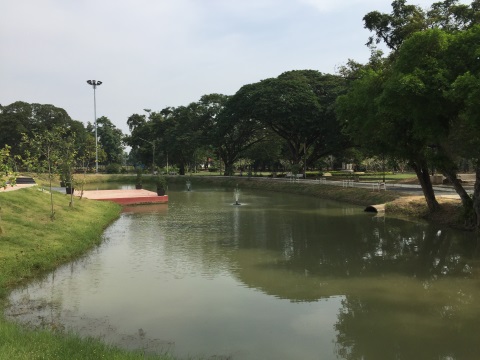
Placid waters of the lake near the monument Across the road from the Bang Rachan Memorial Park is the site of the former fortified village of Bang Rachan or Khai Bang Rachan. This area was registered as a historical site by the Fine Arts Department on 20 December 1954. The reconstructed walls of the fort and main gate line the front of the historical site to set the mood for visitors. 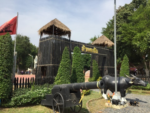
Fort walls in the historical site Wat Pho Kao Ton (temple with nine pho trees), was the village temple during the battle and provided much of the spiritual and moral support to the defenders during the siege. The ruins of the wiharn and a small chedi from the old days are preserved within the present temple grounds. The shrine in the old wiharn is a popular place of worship for visitors. 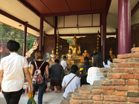
Praying at the shrine – note the old ruins around the shrine It is believed that the pool within the temple grounds contains sacred water. Those whose prayers are answered fulfil their vows by carrying pails of water from a well to fill the pond. 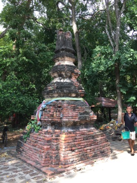
Ruins of an old chedi and a worshipper fulfilling his vow There’s also a school in the historical area that’s named after the fort. 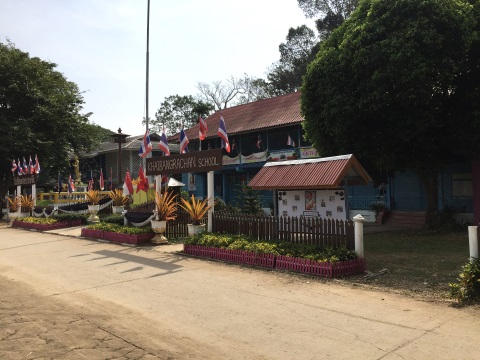
Khai Bang Rachan School Behind the school, under the shade of the woods, the Bang Rachan Market adds a quaint historical touch. We will be presenting this market soon, so I won’t spoil the surprise. The district where the Bang Rachan Memorial Park is located is called Khai Bang Rachan, not to be confused with the Bang Rachan District, another district further north in Singburi. Bang Rachan is well remembered in Singburi. Contents Our thanks Our thanks to the staff of the Bang Rachan Museum who were most hospitable and helpful, especially the two young school children who were our volunteer guides. We wish them well in their future. 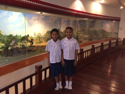
A big thank you to our guides All photographs are with the courtesy of the Bang Rachan Memorial Park. Contents Map to Bang Rachan Memorial Park If the map doesn’t appear, click on this link Address Bang Rachan Memorial Park Bang Rachan Khai Bang Rachan District Singburi 16150 Tel: 036-520030 (Centre for Historical Studies) How to get there By car After you leave Bangkok, head north along Highway 32, past Ayutthaya to Ang Thong. Go through Ang Thong City via – Highway 334 – Highway 3064 to Singburi, then switch to Highway 3032 which will take you to the Bang Rachan Memorial Park. Opening hours and admission fees Open every day, Historical Park - from 0600 – 1800 hours Museum – from 0830 – 1630 hours Admission is free Contents Next month We depart from our regular feature articles to present the Thailand Tourism Festival 2017. If you enjoyed reading this e-zine, please forward it to a friend. If you received this from a friend and found it interesting, please subscribe at Bangkok Travelbug. What do you think of the Bangkok Travelbug? We love to hear from you What other subscribers have said Till next month then. Eric Lim Tour Bangkok Legacies Find us on Facebook If you are an independent traveller, here's a handy e-guide book, Tour Bangkok Legacies, which will help you along as you explore the streets of Bangkok and discover its old treasures. It's complete with historical descriptions, maps and detailed directions on how to get to these places. My Kindle e-book 
Copyright@2008-2017 Tour Bangkok Legacies All rights reserved |
| Back to Back Issues Page |