| Back to Back Issues Page |
 |
|
Bangkok Travelbug March 2019 Exploring Chainat March 07, 2019 |
| Hello
Brief History of Chainat Chainat is another very old city, like Ratchaburi, there was human habitation in Chainat since the prehistoric¹ and protohistoric² eras about 2,500 to 3,000 years ago. Relics in the Chainat Muni National Museum in Chainat City provide the historical evidence; these tools, ornaments and old pots were found in Chainat Province and are currently on display in the museum. 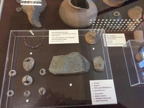
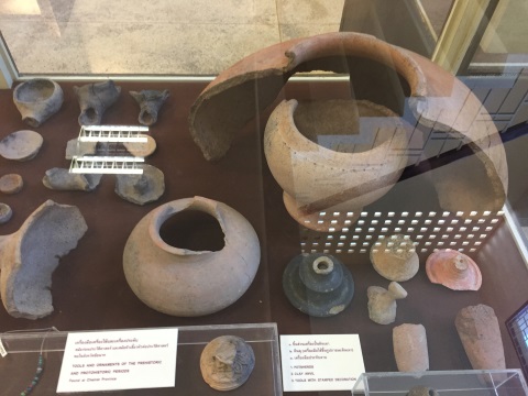
Tools, ornaments, pots from the prehistoric and protohistoric periods ¹Prehistory is the period before recorded history and knowledge is acquired mainly through archaeological discoveries, research and study ²Protohistory is defined as the period between prehistory and history. The protohistoric era is the period during which a culture or civilisation has not yet developed writing and therefore is unable to record its history. However other cultures have noted its existence in their writings. The time period varies from culture to culture. Other displays of old Buddha images found in Chainat Province reflect the history of Chainat through the various eras. The Chainat Muni National Museum will be covered in next month's issue. 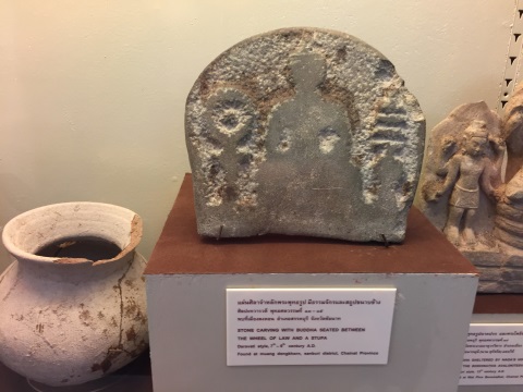
Stone carving of Buddha between the Wheel of Law and a stupa - Dvaravati³ 7th – 9th C AD ³Dvaravati – an ancient Buddhist culture that had an influence on Central and North-eastern Thailand between the 6th – 9th C. 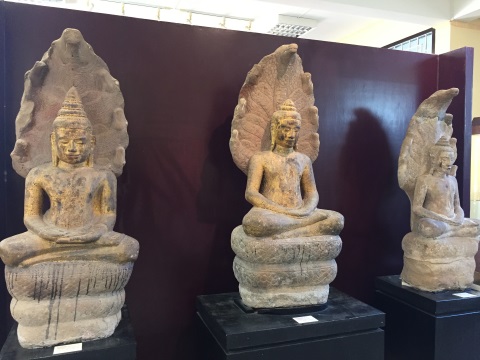
Buddha sheltered by the Naga's hood – Lopburi# period 12th – 13th C #The Lopburi period coincides with the rise of the Angkhor Empire when Lopburi and several other Thai provinces were on the outer fringe of the empire. Old Chainat City or Muang Chainat was originally on the west bank of the Chao Phraya River near the mouth of the Noi River. The administrative centre was based in Wat Phra Boromthat. Later the city was moved to its present location on the east bank. Contents Chao Phraya Dam The Chao Phraya Dam, a prominent landmark in Chainat, was the first large scale dam in Thailand. It was opened on 7 February 1957 by King Rama IX. The reinforced concrete dam is 263 m long and 16 m with 16 floodgates. It releases water from the north to the central basin for irrigation and hydro-electricity. 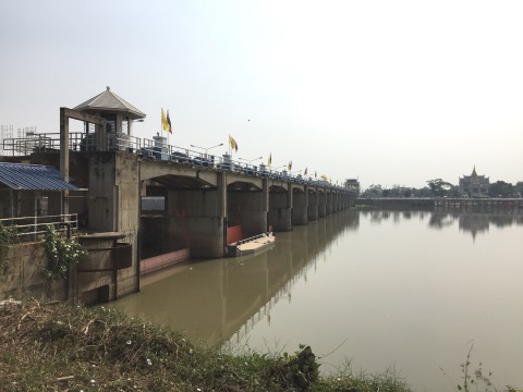
View of the Chao Phraya Dam from the north The power plant and generator are capable of producing 61.75 kWh (kilowatt hours) of electricity. 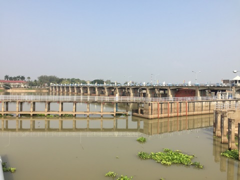
View of the dam from the south There is a small restaurant on the north bank just after the dam after the Chao Phraya Lodging. After a three-hour drive, it's a good place to stop for lunch after viewing the dam. Source: Details of the dam are provided by the Electricity Generating Authority of Thailand (EGAT). 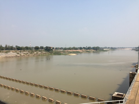
View from the south facing downriver Contents Source of the Tha Chin River Chainat is the source of a major river, the Tha Chin which branches off from the Chao Phraya just north of Chainat City. The Tha Chin twists and turns for more than 350 km* through Chainat, Suphanburi, Nakhon Pathom and Samut Sakhon where it flows out to the Gulf of Thailand at Mahachai in Samut Sakhon. ⃰ Estimates of the length of the Tha Chin vary owing to the numerous meanders in the river as it winds through its flat river basin. 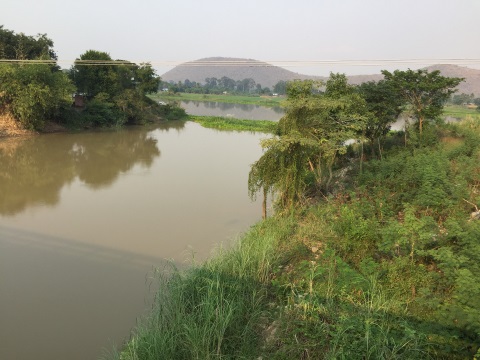
The Chao Phraya is flowing from left to right near the top of the photo, the Tha Chin River is flowing from the top of the photo to the bottom (photo taken facing north-east) The river has a catchment area of 27,000 sq. km, 90% of which is agriculture, mainly rice followed by vegetables and fruits plantations. This river basin forms part of the huge rice bowl in the Central Region of Thailand that provides rice not only to Thailand but for many South-East Asian countries. 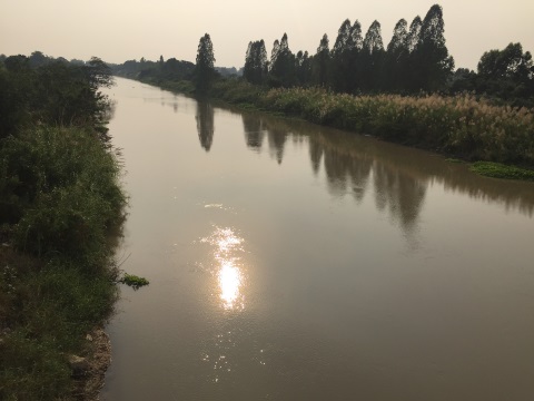
The Tha Chin in the late afternoon (photo taken facing south-west). There is an interesting story about how the river got its name. In the 1800's, Chinese trading junks used to berth at the estuary to trade with the locals. As a result, the estuary and the town at the estuary was called Tha Chin or Chinese Port, (tha – port, chin – Chinese). The name of the town at the estuary was eventually changed to Mahachai. But the name Tha Chin was adopted for the entire length of the river. 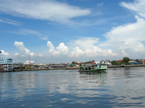
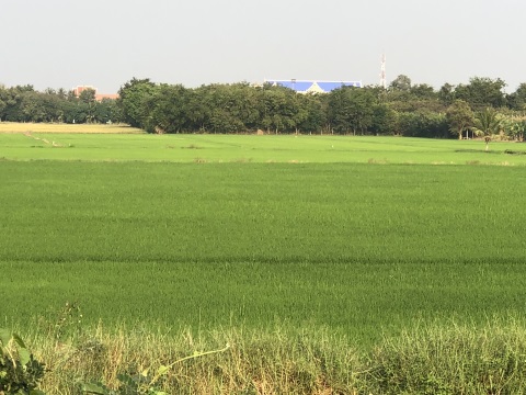
The Tha Chin taken from Tha Chalom looking towards Mahachai, Samut Sakhon more than 200 km south of Chainat. Contents The Chainat Landscape Drive out of Chainat City on the west bank of the Chao Phraya and you'll see vast, green rice fields all over. The farmers here have the advantage of a constant source of water supply from two rivers thus enabling several rice crops a year. This is evident from the rice fields at different stages of cultivation. 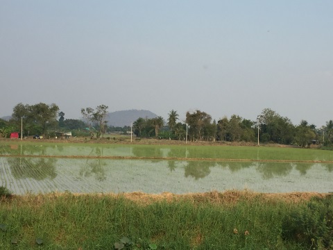
Recently planted rice field 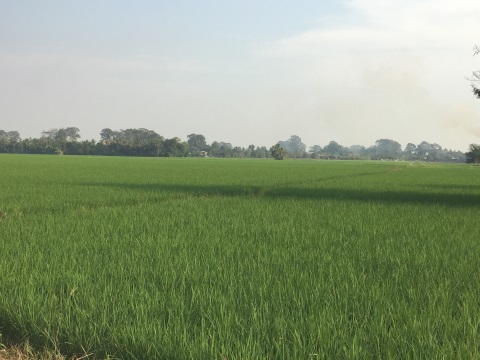
A mature rice field We passed a recently harvested rice field and I learnt something new. The stalks left behind after a harvest pose a problem of disposal to make way for the new crop; some farmers choose to burn them and cause pollution. The farmers here bind the stalks into neat bundles; there's a use for them. These stalks are laid as top soil for vegetable plots because they retain water better and the farmers don't have to waste water and effort watering the vegetable plots frequently. 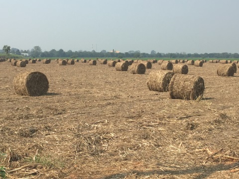
Bundles of hay I learn something new every trip out into the country. Riverside Resorts As Chainat is on the banks of the Chao Phraya River, there are a number of beautiful riverside resorts available. We stayed at one and had dinner at another. The Suwanna Riverside Resort is a cosy family resort with two-storey buildings nestled among lush greenery and beautifully landscaped gardens. 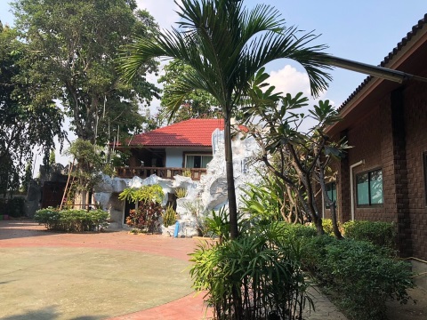
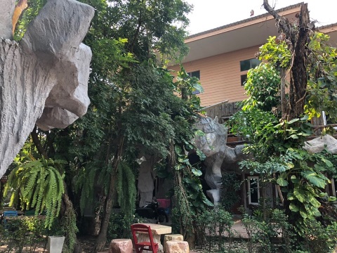
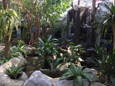
Suwanna Riverside Resort The Chao Phraya Thara Riverside is more like a conventional hotel building. Both hotels have river terraces where dinner is served. There was a wedding party at the Chao Phraya Thara which was held indoors. We had dinner on the river terrace and had it all to ourselves. 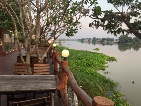
River terrace of the Chao Phraya Thara Riverside I leave you with this memorable shot of the Chao Phraya early in the morning taken from the terrace of the Suwanna Riverside Resort. See you next month. 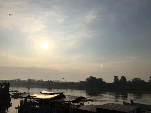
Chainat early in the morning Contents Map of Chainat If the map doesn’t appear, click on this link How to get there By car There are two possible routes to Chainat from Bangkok. Highway 338 – highway 9 – highway 340 to Suphanburi – continue on highway 340 till you get to Chainat. Distance – 196 km. Alternatively, you can take Don Muang Tollway – highway 1 – highway 32 past Ayutthaya, Singburi – highway 1 to Chainat. Distance – 199 km. Accommodation Other hotels are included in the map to give visitors a wider choice. Contents Next month Chainat Attractions If you enjoyed reading this e-zine, please forward it to a friend. If you received this from a friend and found it interesting, please subscribe at Bangkok Travelbug. What do you think of the Bangkok Travelbug? We love to hear from you What other subscribers have said Till next month then. Eric Lim Tour Bangkok Legacies Find us on Facebook My Journey through Thailand Part I The First Steps This is my second e-book and the first in the series of travel journals on my trips to explore the various provinces in Thailand. This edition, which covers my travels from late 2009 to mid-2013, will guide you to historical sites, cultural monuments and exquisite Thai handicraft, across a vast spectrum of cultural and ethnic diversity. You can have a virtual tour with this e-guide book or take the first steps yourself in this journey through Thailand. My Kindle e-book 
Copyright@2008-2019 Tour Bangkok Legacies All rights reserved |
| Back to Back Issues Page |