| Back to Back Issues Page |
 |
|
Bangkok Travelbug October 2019 Nakhon Sawan – Start of the Chao Phraya October 22, 2019 |
| Hello
Nakhon Sawan is located at the northern fringe of the Central Region, about 250 km north of Bangkok. The name of the province, (Nakhon – city, Sawan – heaven) means Heavenly City and the provincial seal depicts the Wiman or "palace in the sky" as described in Hindu and Sanskrit texts. 
Nakhon Sawan Province seal – the Heavenly City 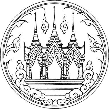
Wiman – the palace in the sky Nakhon Sawan is a very old city dating back to the days when Lopburi was part of the Angkor Empire and a king of Lopburi left an inscription in Nakhon Sawan in 1167. King Ramkhamhaeng's inscription in 1279 included a passage indicating the cities and provinces that have submitted to the rule of Sukhothai; these include Chainat, Suphanburi, Phisanulok and Nakhon Sawan. The location of Nakhon Sawan at the junction of three major rivers during a time when river travel was essential for trade and the movement of troops gave the city its strategic importance. As the city kingdoms jockeyed for power, Nakhon Sawan became the prize that was constantly changing hands. When Ayutthaya came into power, King Borommaracha captured Nakhon Sawan, Phisanulok and Kamphaeng Phet in 1378 to secure his northern flank. In 1400 Sukhothai recaptured Nakhon Sawan from Ayutthaya. During the Burmese-Siamese Wars, Nakhon Sawan was one of the launching areas for Burmese forces to attack Ayutthaya. The rivers provided the channels to mass the troops at Nakhon Sawan. From there it was plain sailing to Ayutthaya. During the Burmese-Siamese Wars in the reign of King Rama I, Nakhon Sawan again featured in the battle plans. The Siamese deployed rapidly to Nakhon Sawan to pre-empt the Burmese from concentrating there and moving south. Reference: Thailand – A Short History by David K Wyatt, Second Edition, Silkworm Books 2004. Contents Chao Phraya River Basin The Chao Phraya River is formed by the waters of four rivers; Ping River from Chiang Mai, Wang River from Lampang which joins the Ping in Tak Province, Nan River from Nan and the Yom River from Phayao which joins the Nan in Nakhon Sawan. 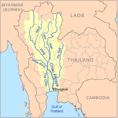
The Chao Phraya River basin The Ping and the Nan merge in Paknam Pho District in Nakhon Sawan City to form the Chao Phraya River – the River of Kings. From Nakhon Sawan, the Chao Phraya winds through Uthai Thani, Chai Nat, Singburi, Ang Thong, Ayutthaya, Pathum Thani, Nonthaburi, Bangkok and out to the Gulf of Thailand in Samut Prakarn, a distance of 372 km or 231 miles. The Chao Phraya Basin covers 20,126 sq. km or 60, 975 sq. miles. At Chai Nat, the Tha Chin River branches off from the Chao Phraya and meanders for 350 km through Chai Nat, Suphanburi, Nakhon Pathom and out to the Gulf of Thailand at Samut Sakhon, creating a basin of 13,681 sq. km or 5,282 sq. miles The entire Chao Phraya drainage basin consisting of its distributaries* (branches) and tributaries* amount to about 160,000 sq. km or 61,000 sq. miles. This huge basin in a rich alluvial plain together with connecting canals forms an vast transportation network in the early days before road travel when boats were widely used. Then and now, the fertile soil and the waterways that form the irrigation system in Central Thailand support the rice bowl of Thailand and the rice eating nations in South-east Asia and the world. Bueng Boraphet is a fresh water swamp and lake just east of Nakhon Sawan City, near the source of the Chao Phraya River. It's about 224 sq.km or 94 sq. miles. During our visit, we noticed huge earthworks taking place in and around the swamp. 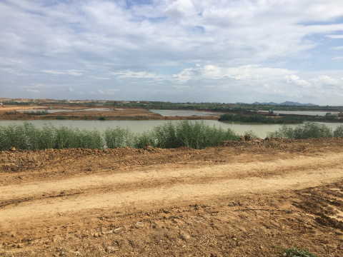
Earthworks at Bueng Boraphet The locals told us that they were expanding and deepening the swamp so that extra water flowing down from the north during the wet season can be stored here to be released during the dry season. This will help elevate the perpetual drought and flood problems plaguing the riverine provinces during the year. *Note: Distributary – a stream or river that splits off from a larger river and flows off in a different direction usually to the sea or lake. Tributary – a stream or river that flows into a larger river. Contents The viewing points You can view the start of the Chao Phraya River from the Chao Pho Theparak – Chao Mae Thapthim Shrine along route 225 which is south of the Nan River. 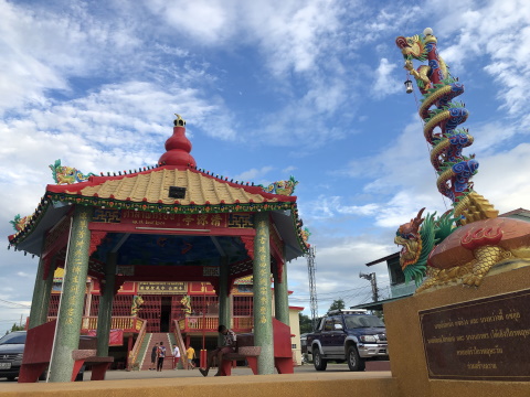
The Chao Pho Theparak Chao Mae Thapthim Shrine 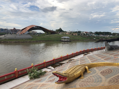
View from the shrine towards the start of the Chao Phraya 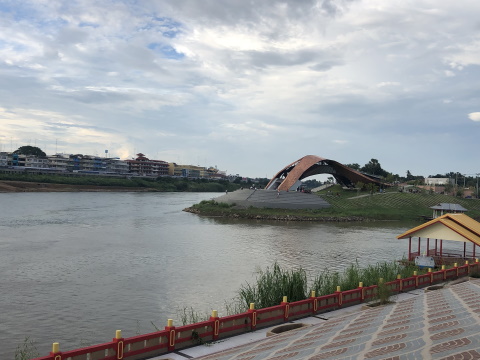
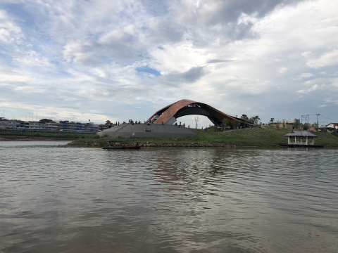
The start of the Chao Phraya is at the tip of the neck of land, the river then flows to the south-west (left of photo) This was what we did initially. But it would be far better if you can view the start of the river from the narrow neck of land between the Ping and Nan Rivers. There is a beautiful viewing point there which we only discovered on arrival. 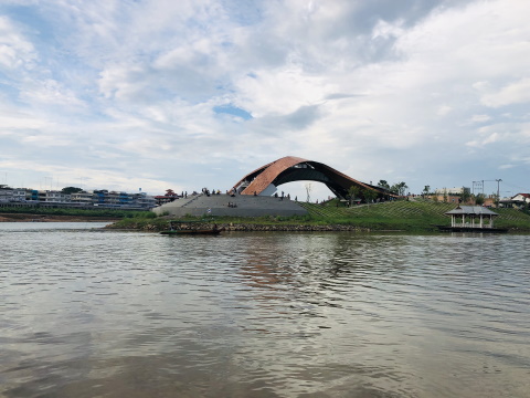
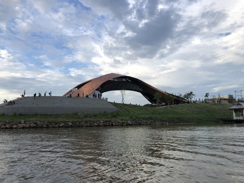
The viewing point on the narrow neck of land between the Ping and Nan Rivers, the Chao Phraya is to the left Fortunately, there is a boat service for 10 baht per head to take you across. Get the boatman's phone number and call him when you want to get back. It's another 10 baht per head for the return trip. 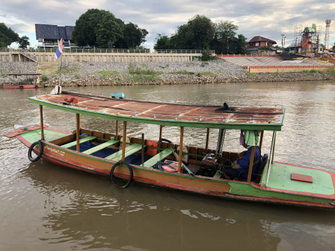
The boat service from the shrine to the viewing point From the viewing point, you can literally stand at the start of the Chao Phraya River and look downriver. 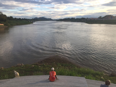
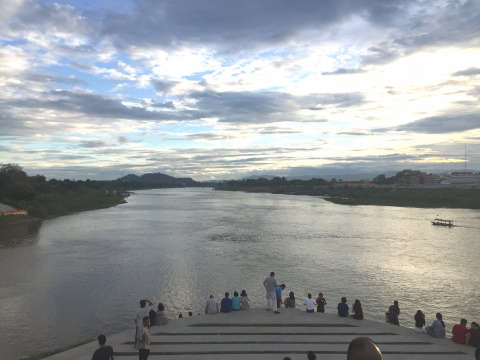
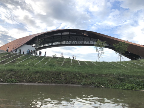
Looking downriver at the Chao Phraya – the Nan is to the left (south) and the Ping is to the right (north) Walk around the viewing area, it's a beautiful structure and there are lots of photo taking opportunities. In the photo below the balcony faces the start of the Chao Phraya River. You can get the best view from here. 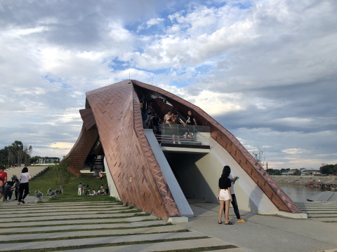
The viewing point Before long, it's time to go. If you came by boat, remember to get the number of the boatman before you alight so you can call him to come and get you. 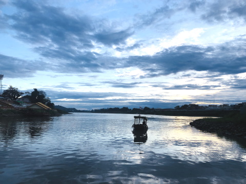
Time to leave for the other bank 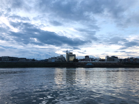
Nakhon Sawan City at dusk Contents Where to stay and dine When we passed Nakhon Sawan a few months ago on the way to Phisanulok, we passed this quaint hotel just before the bridge across the River Ping. In Thai the hotel is named, "Mi Kot Mon" or "Bear Hugs the Pillow". The name in English and French is Chateau de Bear. 
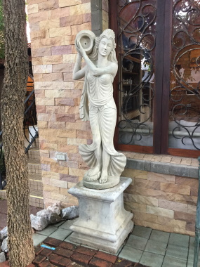
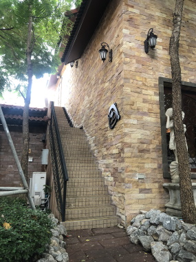
Mi Kot Mon This hotel is built like a medieval Italian village complete with matching décor and even a suit of knight's armour. The only thing missing is a street of cobbled stone. It's located at the northern end of Nakhon Sawan City and provides clean, comfortable and convenient accommodation if you wish to explore the city. 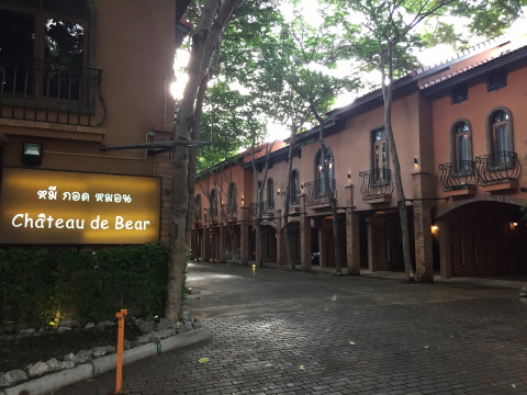
Chateau de Bear The hotel rate at 900 baht per night plus breakfast for two is very good value for money. 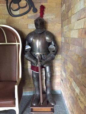
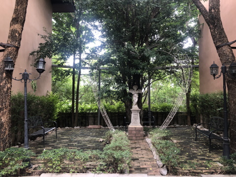
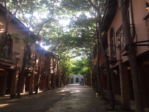
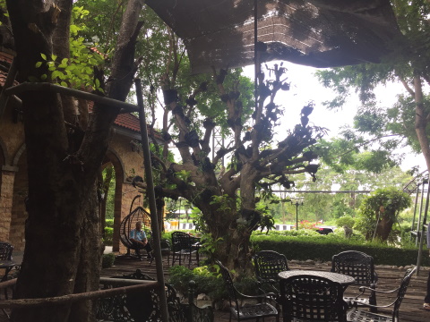
The hotel grounds What appears to be the entrance to a chapel is just a façade. More accommodation is available through a small door to the left. 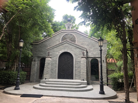
The chapel to the rear The Kung Pau 2 Restaurant that's just across the Ping River serves a wide variety of deliciously barbecued seafood. 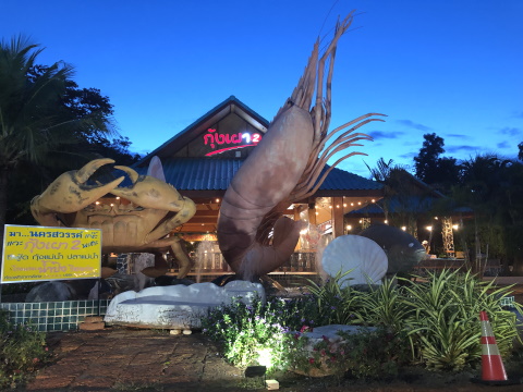
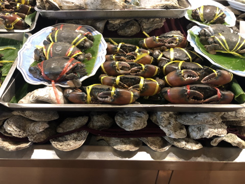
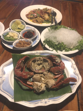
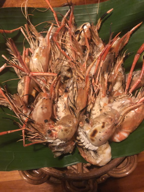
Crabs, oysters and prawns at Kung Pau 2 The bear must be the mascot of Nakhon Sawan as there is a Bear Head Kitchen in the city that serves tasty soups, steaks and chops for a quick lunch. 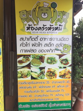

Bear Head Kitchen With that we end our initial exploration of Nakhon Sawan. Join us again next month, to explore some of the city's other attractions. Contents Map of Nakhon Sawan If the map doesn’t appear, click on this link How to get there From Bangkok take Phahon Yothin Road or highway 1 – highway 32 all the way to Nakhon Sawan. At the outskirts of the city, just before the Detchatiwong Bridge turn right into route 225. Turn off to the left to go to the Chao Pho Theparak – Chao Mae Thapthim Shrine. This will take you to the bank opposite the narrow tongue of land where the Chao Phraya River starts. From here you can take a boat across and back. Alternatively, you can drive straight along route 225 and turn left to cross the Dusitaphum Bridge that takes you across to the narrow neck of land where the Chao Phraya River starts. To get to Chateau de Bear, continue on highway 1, cross the Dechatiwong Bridge and turn off to route 117 that passes through Nakhon Sawan City. Proceed on route 117 till you see the hotel signboard on your left just before the second bridge. The Kung Pao 2 Restaurant is just across the second bridge from Chateau de Bear and the Bear Head Kitchen is right in the city centre. Opening hours Opening hours of Chao Pho Theparak – Chao Mae Thapthim Shrine and the viewing facility between the Ping and Nan Rivers are from 08:00 am – 05:00 pm. Admission Admission to the Chao Pho Theparak – Chao Mae Thapthim Shrine is free. So is access to the viewing point between the Ping and Nan Rivers. Have a safe and enjoyable trip! See you next month as we explore the rest of Nakhon Sawan. Contents Next month Nakhon Sawan City Attractions If you enjoyed reading this e-zine, please forward it to a friend. If you received this from a friend and found it interesting, please subscribe at Bangkok Travelbug. What do you think of the Bangkok Travelbug? We love to hear from you What other subscribers have said Till next month then. Eric Lim Tour Bangkok Legacies Find us on Facebook My Journey through Thailand Part I The First Steps This is my second e-book and the first in the series of travel journals on my trips to explore the various provinces in Thailand. This edition, which covers my travels from late 2009 to mid-2013, will guide you to historical sites, cultural monuments and exquisite Thai handicraft, across a vast spectrum of cultural and ethnic diversity. You can have a virtual tour with this e-guide book or take the first steps yourself in this journey through Thailand. My Kindle e-book 
Copyright@2008-2019 Tour Bangkok Legacies All rights reserved |
| Back to Back Issues Page |