| Back to Back Issues Page |
 |
|
Bangkok Travelbug February 2020 Abandoned Temples Sangkhla Buri January 30, 2020 |
| Hello
Impact of the Vajiralongkorn Dam The Vajiralongkorn Dam is a concrete face slab rock-filled dam, 92 m (100.61yards) high, 1,019 m (1,114.39 yards) long, 10 m (10.93 yards) wide. Construction of the dam started in 1979 across the Kwae Noi River in Thong Pha Phum district, south of Sangkhla Buri. When the dam was completed in June 1984, the reservoir created stretches all the way to Sam Prasob in Sangkhla Buri, 40 km to the north. 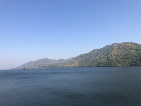
View of reservoir from the dam looking north to Sangkhla Buri The reservoir covers an area of 388 sq. km (149.80 sq. miles) and has a holding capacity of 8,860 cubic m (2.34 m US gallons or 1.94 m Imperial gallons) of water. The dam was officially opened on 9 January 1986 by King Rama IX. 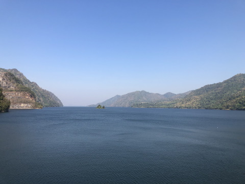
Scenic view from the dam Originally named Khao Laem Dam, it was renamed Vajiralongkorn Dam on 13 July 2001 after Crown Prince Maha Vajiralongkorn (currently King Rama X). 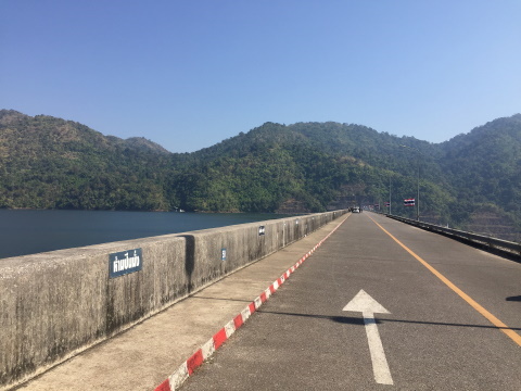
Road on top of the dam The dam has three 100 MW conventional hydroelectric generating units with a capacity of 300 MW of installed capacity. Source: Electricity Generating Authority of Thailand (EGAT) 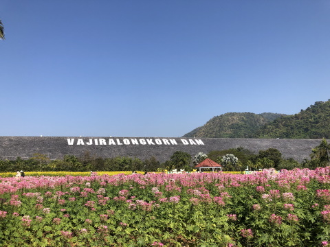
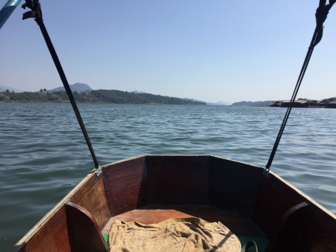
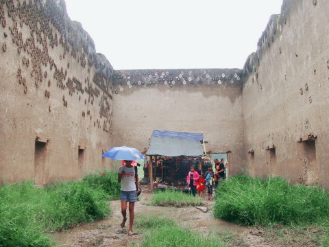
Beautiful park south of the dam With the flooding of the Kwae Noi valley, the Mon community in Wang Ka and three temples had to be abandoned. We will visit the sites of these abandoned temples and then show visitors the sites of the new temples built to replace the abandoned ones. Contents Wat Wang Wiwekaram The sunken ruins of Wat Wang Wiwekaram are located about 1.7 km south-east of the Chedi Buddha Gaya and consist of two structures; hor rakhang (the belfry or bell tower) and ubosot (ordination hall). These ruins are quite close to the shore and if you view the satellite image of the area, you can see the ground below the water's surface. As our visit was in December when the water level in the reservoir was high, only the top of these structures could be seen above the water line. The roof of the belfry still looks in relatively good condition. 
Top of the hor rakhang or bell tower But what can be seen of the ubosot appeared to be dilapidated. 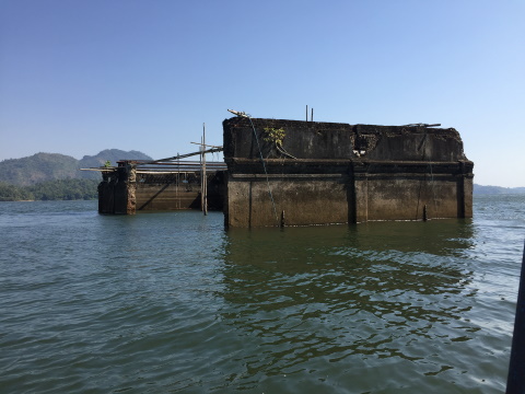
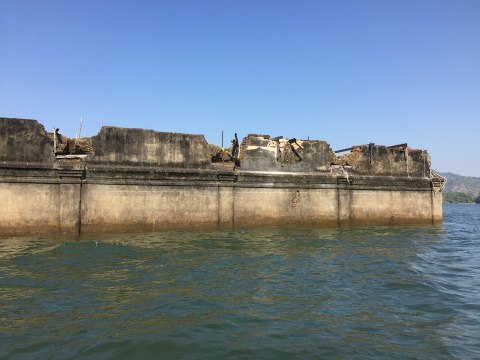
Top of the ubosot We had a lucky break here, a family friend visited the area 10 years ago in July 2009. It was at the start of the rainy season and the water level in the reservoir was still low. Here are some photographs of these two structures completely exposed. Judging from the condition of the bell tower then and now, it appears that some repairs were made to the roof since then. 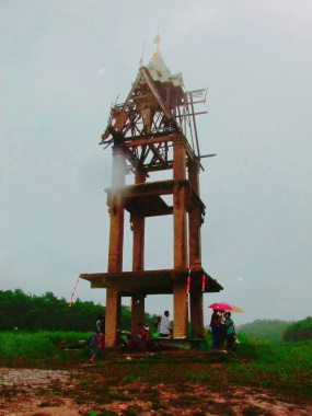
The belfry fully exposed 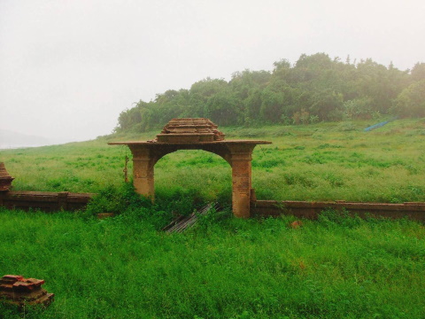
Remains of the arch and walls to the ubosot 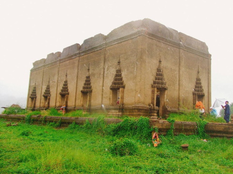
The ubosot from the outside and inside As for the new Wat Wang Wiwekaram, it was featured in last month's issue of the Travelbug. Here are the photos again. 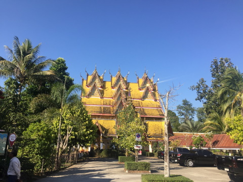
The ubosot 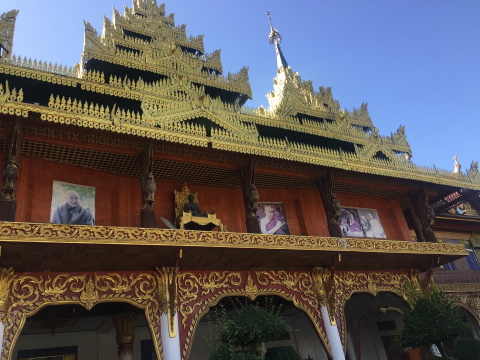
The kuti or monks' quarters Contents Wat Somdet On a hill on the eastern shore of the reservoir, a gentle slope leads up to the ruins of old Wat Somdet. It was probably abandoned because, with the flooding of the valley, the western and easier approach to the temple was completely cut off. A glance at the satellite map will show that the eastern approach to the temple is very hilly and forested with no roads at all. It would not be practical to have the temple remain in this location. As we walked up the slope from the shore to the temple, a school girl approached us offering her services as a guide to earn some pocket money. We obliged her and she proved to be quite knowledgeable. 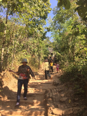
Path leading to Wat Somdet If the temple was abandoned in 1979 when construction of the dam commenced, it must have been abandoned almost 40 years! Even within this relatively short period, the ruins of Wat Somdet have assumed the appearance of very old historical ruins! 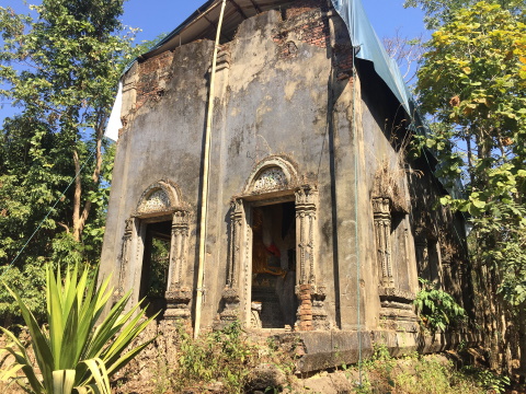
The old ubosot 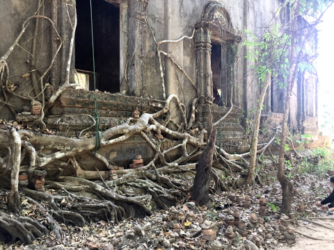
The base of the ubosot is entwined in tree roots There is a huge Buddha statue in the sitting position inside the old ubosot and visitors were going in to pray. Our guide related to us a very strange custom here. Worshippers going into the ubosot to pray, enter by the front door and leave by the rear, ladies leave by the left rear door and men by the right rear door. 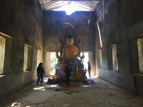
Buddha statue in the sitting position, note the man leaving by the right rear door 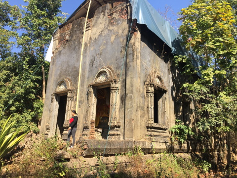
Lady leaving by the left rear door (left as seen from the inside) One look at the eastern side of the temple and we can understand why it was abandoned. This photograph of the ground east of the temple confirms the difficult approach. 
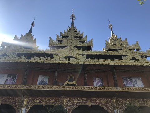
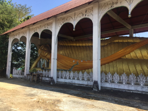
Thick foliage to the east The new location of Wat Somdet is far more accessible. It’s the first temple you will see as you approach Sangkhla Buri town. The ubosot (ordination hall) is on the left as you drive towards town. So is this set of chedi and a huge statue of a reclining Buddha. 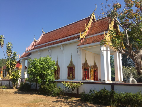
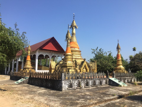
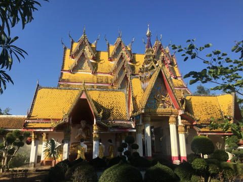
Wat Somdet (new) Across the road on the right as you are driving towards town are more Buddha statues and another set of chedi. 
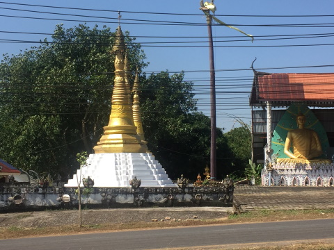
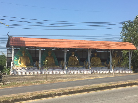
The other side of Wat Somdet Contents Wat Si Suwan The old Wat Si Suwan, our last stop, must have been located in the lowest point in the valley. When the waters in the reservoir are high, the old temple is completely inundated, with only a marker and a Thai flag to show its position. 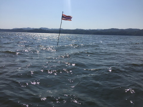
All that can be seen of old Wat Si Suwan today The new Wat Si Suwan is located in Sangkhla Buri town which we visited on our last day there. The arch over the entrance to the temple is beautifully engraved with carvings. 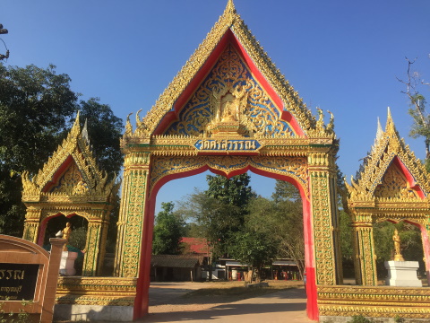
Entrance to Wat Si Suwan The windows and gable of the ubosot (ordination hall) has similar elaborate carvings too. Unfortunately, the gate to the ubosot was locked and we couldn't get in for a closer look. This was as close as we could get. 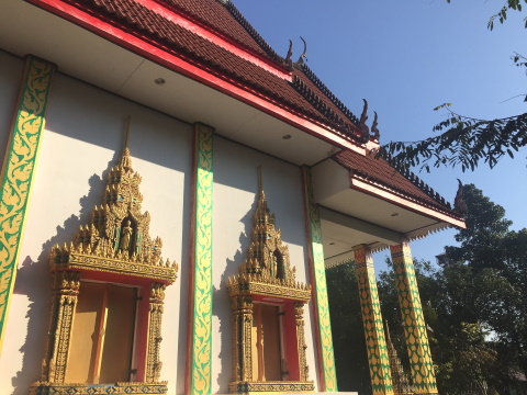
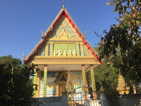
The ubosot 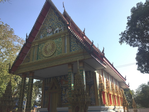
Rear view of the ubosot Other structures within the temple grounds included this chedi. 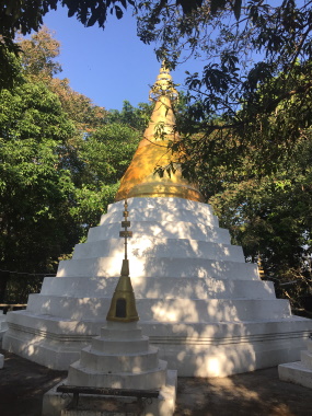
Chedi Contents Our thanks Our thanks to Nateanong Kongprachum, a family friend for sharing the photographs of her visit to the reservoir 10 years ago. Those photographs gave us a better insight to what the sunken Wat Wang Wiwekaram was like. Contents Map to Abandoned Temples If the map doesn’t appear, click on this link How to get there For details on how to get to Sangkhla Buri town and where to stay, please refer to the details in the map section of the Bangkok Travelbug January 2020. How to book the boat trip There are many boat services available at the Mon Bridge. However. we found that we got the best deal by booking at the front desk of the Sam Prasob Resort where we stayed. It cost 400 baht to charter the boat for the three-temple tour. The boat can seat four persons comfortably. This cost less than the 500 baht to charter the boat as advertised by one of the operators. Furthermore, the services there included tours to several other places which we were not interested in. After we booked through the resort, the boat man will arrive at the resort in a motor-cycle sidecar to take us down to the shore of the reservoir to board the boat. Have a safe and enjoyable trip! See you next month. Next month we will visit the Three Pagoda Pass which is the Myanmar-Thai border crossing in north-west Thailand and review the long history of this pass. See you then. Happy Saint Valentine's Day! Contents Next month The Three Pagoda Pass If you enjoyed reading this e-zine, please forward it to a friend. If you received this from a friend and found it interesting, please subscribe at Bangkok Travelbug. What do you think of the Bangkok Travelbug? We love to hear from you What other subscribers have said Till next month then. Eric Lim Tour Bangkok Legacies Find us on Facebook My Journey through Thailand Part I The First Steps This is my second e-book and the first in the series of travel journals on my trips to explore the various provinces in Thailand. This edition, which covers my travels from late 2009 to mid-2013, will guide you to historical sites, cultural monuments and exquisite Thai handicraft, across a vast spectrum of cultural and ethnic diversity. You can have a virtual tour with this e-guide book or take the first steps yourself in this journey through Thailand. My Kindle e-book 
Copyright@2008-2020 Tour Bangkok Legacies All rights reserved
|
| Back to Back Issues Page |